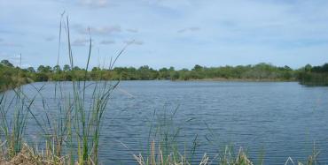
As South Florida experienced torrential rain Wednesday, with more promised through the weekend, folks in communities east, west and south of Lake Okeechobee nervously watched the big lake rise.
Coastal residents who last year experienced lake discharges that sickened rivers and estuaries with algal blooms and green goop -- 200 billion gallons of water discharged from the big lake into the St. Lucie estuary alone -- are understandably jumpy. 2016 was an unusually, horrifyingly wet year.
"I used to enjoy a good storm," Stuart shopkeeper Grace Hotchkiss told Sunshine State News Wednesday. "Not anymore. I have too many bad memories from a year ago."

In the drought conditions of a week ago, the lake was under 10 feet. By Wednesday, rains had pushed it back up to 11.2 feet. Which means there's still breathing room in Lake O. For now. The U.S. Army Corps of Engineers is unlikely to open the lock gates until the lake level reaches 15-foot-6.
But something else has begun to happen. In some easily flooded areas, canals have risen farther above sea level than the lake.
Have a look at the water levels chart at the bottom of this story, showing DBHydro's figures from 6 p.m. Wednesday. What the water table shows are inflows to Lake Okeechobee from the Martin County side -- the St. Lucie Canal -- because the lake level is lower than the canal water flowing in the from the east. The data point showing this is -8432 under “Lake to Canal” in the water table below.
During periods of discharges, this number would be positive, but because the water is flowing INTO Lake Okeechobee, it shows as negative.
I mention this now because last year, so many of us in the media got it wrong. We followed the Sierra Club's egregious lead like sheep, claiming as they did in an NBC2 story that farmers were backpumping polluted storm water into the lake to save their flooded crops.
According to the Sierra Club, sugar farmers were creating an "ecological disaster." Meanwhile, the media missed the 1 million-plus acre feet of nutrient-laden runoff communities as far north as Orlando were adding to the lake.
The point is, backpumping could happen again this year if, God forbid, conditions approach the emergency levels they did last year.
The point is, 1) farmers have no say in the decision to backpump, 2) they have no authority to turn on the pumps themselves and 3) the South Florida Water Management District, the agency in charge of flood control, isn't the least bit interested in keeping agricultural fields dry -- they backpump when communities -- people -- south of Lake Okeechobee are flooded.
One of the District's most important jobs is keeping people safe.
Last year, with Belle Glade and nearby communities facing potentially dramatic flooding, water managers used two pumps on the south side of Lake Okeechobee to reduce water levels in the adjacent canals, preventing significant urban flooding.
"Though rare in frequency," says district spokesman Randy Smith, "the back-pumping efforts have protected Glades families for decades."
The bottom line: SFWMD has a plan for where floodwaters in all 16 of its counties go. In Martin and Lee counties, the water is sent east and west to tide. In the Glades, it's pumped into the lake. That's the plan for Belle Glade, Pahokee and South Bay.
Last year, I followed the herd and wrote a Sierra Club-style story I had to correct and apologize for.
This year I want people to understand farmers have no say in when pumps are turned on or how long they stay on. Their fields, meanwhile, are at the mercy of Mother Nature.
But Glades residents living within urban boundaries have a right to the same flood protections as people living in Stuart, Fort Pierce, Fort Myers, Wellington, Plantation or anywhere else in South Florida.

Reach Nancy Smith at nsmith@sunshinestatenews.com or at 228-282-2423. Twitter: @NancyLBSmith
READ MORE FROM SUNSHINE STATE NEWS


